Home
Weather Maps
Tables
Forum
Community
Service
Shop
My AWEKAS
AWEKAS Home
AWEKAS Mobile Home
Data protection
Imprint
Weather overview
Temperature
Air Pressure
Wind
Precipitation
Snow
Webcam
Sun
Dew point
Humidity
Current weather data
Current weather situation
Current weather warnings
Forum overview
News
Help and instructions
Wishes and suggestions
Register new
Memberlist
Member Map
Donations to AWEKAS
Banner and logo
Weather widget
AWEKAS shop
My station panel
Instrument designer
Stationsweb
Change user data
Report your weather
Data import/export
AWEKAS Benutzer:
login
Nearest stations
Information for station Tenneck
Abtenau
Bischofshofen
Bischofshofen Sbg.
Golling
Golling a d Salzach
Kuchl-Jadorf
Lungötz/Annaberg
Mühlbach a.Hochkönig
Pirstingerkogel
Schönau am Königssee
St.Johann im Pongau
St.Veit im Pongau
Tenneck Rainlehen
Station name
Tenneck
Country
Austria
Height above sea level
538 m
Geographical position
13° 10' 24.73'' East / 47° 29' 38.55'' North
Data transfer
Froggit Fastlink
Last updated
25.6.2025 15:25
AWEKAS Plus
YES
AWEKAS id
19556
Stations blog
edit
no station blog available
Information for station
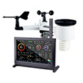
Type of station
Froggit HP2000
these sensors are in use
count
Temperature
1
Air Pressure
1
Precipitation
heated
1
Anemometer
mounting height: 10 m
1
UV
1
Solar radiation
1
Link to station website Tenneck
To map
Compare values with adjacent stations
To instrument page of the station
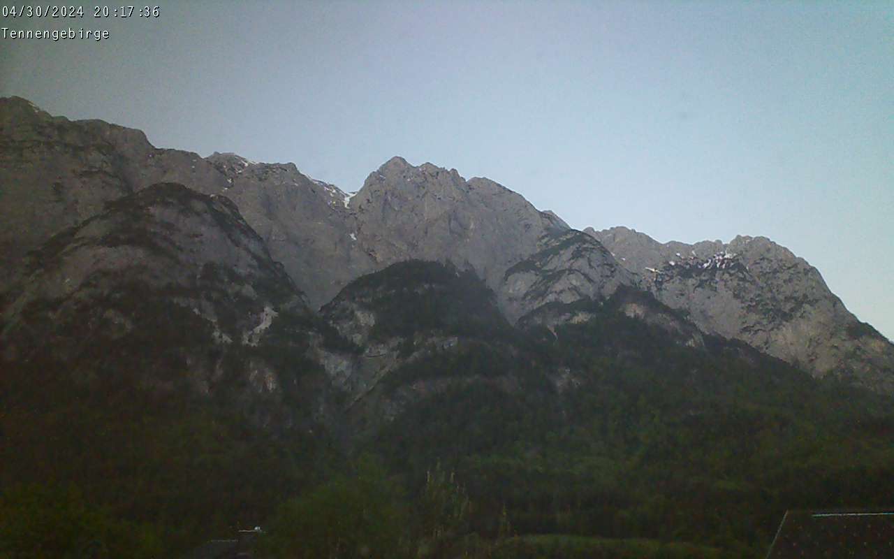
Picture from : 1.7.2025 - 18:54
Sponsoring
MEMBERS
15631 Members at this time
11080 stations online
New stations:
Freital Somsdorf
Altrip
Winnweiler 2
Pfäffikon MCH
Zürich /Kloten MCH
Weather Report
Big Canoe, GA
overcast sky / 29.1°C -
Albertville
heavy cloud / 36.2°C -
Current Warnings
no warnings at the moment
Minimum/ Maximum
Temperature
Ruhland (Zentrum)
48.9°C -
Ferniehurst
-3°C -
Wind Speed
Leuchtturm Kiel DWD
38.5km/h - E -
Precipitation
Mandi,Himachal Prad.
126 l/m² -
Visitors today: 10402
currently 96 visitors on AWEKAS
Display Settings
Language
German
English
Dutch
French
Italian
Spanish
Measurement Units
Metric system
American system