Home
Weather Maps
Tables
Forum
Community
Service
Shop
My AWEKAS
AWEKAS Home
AWEKAS Mobile Home
Data protection
Imprint
Weather overview
Temperature
Air Pressure
Wind
Precipitation
Snow
Webcam
Sun
Dew point
Humidity
Current weather data
Current weather situation
Current weather warnings
Forum overview
News
Help and instructions
Wishes and suggestions
Register new
Memberlist
Member Map
Donations to AWEKAS
Banner and logo
Weather widget
AWEKAS shop
My station panel
Instrument designer
Stationsweb
Change user data
Report your weather
Data import/export
AWEKAS Benutzer:
login
Nearest stations
Information for station Nachrodt
Ardey
Balve
Balve (Beggenbeil)
Balve-Mellen
DO-Aplerbeck-West
Dortmund-Hörde
Dortmund-Sölde
Ennepetal-Voerde
Hagen-Halde
Hagen-Haspe
Herdecke-Westende
Herscheid-Hüinghsn.
Holzwickede
Iserlohn-Genna
Iserlohn-Letmathe
Iserlohn-Nord
Iserlohn-Sümmern
Iserlohner Heide
LÜD-Stüttinghausen
Lüdensch-Wettringhof
Lüdenscheid
Lüdenscheid DWD
Lüdenscheid-Wehberg
Mellen b. Balve
Neuenrade
Schwerte
Schwerte-Ergste
Werdohl
Werdohl-Kleinhammer
Werdohl-Süd
Wiblingwerde
Station name
Nachrodt
Country
Germany
Height above sea level
245 m
Geographical position
7° 38' 15'' East / 51° 19' 48'' North
Data transfer
Froggit Fastlink
Last updated
12/6/2025 5:59 pm
AWEKAS Plus
YES
AWEKAS id
9393
Stations blog
edit
no station blog available
Information for station
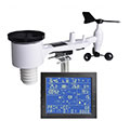
Type of station
Froggit WH4000SE
these sensors are in use
count
Temperature
1
Air Pressure
1
Precipitation
1
Anemometer
mounting height: 9.84 ft
1
Link to station website Nachrodt
To map
Compare values with adjacent stations
To instrument page of the station
Sponsoring
MEMBERS
18458 Members at this time
13217 stations online
New stations:
TKS Erfurt
Goedgegewe
Olsbg-Bruchhausen
Schwabenbach
Defiance, MO
Weather Report
Cuers
heavy cloud / 56.8°F -
Reichmannsdorf
overcast sky / 34.7°F -
Current Warnings
no warnings at the moment
Minimum/ Maximum
Temperature
Rosario Santa Fe
95.7°F -
Anola, MB
-5.3°F -
Wind Speed
Mont Aigoual MF
55.2 mph - NW -
Precipitation
Velika (Tsarevo)
3.3 in -
Visitors today: 4867
currently 39 visitors on AWEKAS
Display Settings
Language
German
English
Dutch
French
Italian
Spanish
Measurement Units
Metric system
American system