Home
Weather Maps
Tables
Forum
Community
Service
Shop
My AWEKAS
AWEKAS Home
AWEKAS Mobile Home
Data protection
Imprint
Weather overview
Temperature
Air Pressure
Wind
Precipitation
Snow
Webcam
Sun
Dew point
Humidity
Current weather data
Current weather situation
Current weather warnings
Forum overview
News
Help and instructions
Wishes and suggestions
Register new
Memberlist
Member Map
Donations to AWEKAS
Banner and logo
Weather widget
AWEKAS shop
My station panel
Instrument designer
Stationsweb
Change user data
Report your weather
Data import/export
AWEKAS Benutzer:
login
Nearest stations
Information for station Kempten DWD
Altusried
Altusried-Krugzell
Dietm'rd-Haldenmühle
Dietmannsried
Freibrechts Hof
Günzach-Rohr
Haldenwang
Haldenwang-Pfaffenh.
Immenstadt - Stein
Kempten Rothkreuz
Kempten-Thingers
Kraftisried II
Lauben
Marktoberdf.-Fechsen
Mittelberg1 (Allgäu)
Mittelberg2 (Allgäu)
Oy-Mittelberg DWD
Waltenhofen
Wigg'b.-Schmidsreute
Wiggensbach-Ermeng.
Wildpoldsried
Station name
Kempten DWD
Country
Germany
Height above sea level
705 m
Geographical position
10° 20' 5.28'' East / 47° 43' 23.88'' North
Data transfer
manuell
Last updated
11.12.2025 06:50
AWEKAS Plus
YES
AWEKAS id
44149
Stations blog
edit
no station blog available
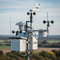
Information for station
Type of station
DWD-Wetterstation
these sensors are in use
count
Temperature
1
Air Pressure
1
Precipitation
1
Anemometer
mounting height: 3 m
1
UV
1
Solar radiation
1
Soil temperature
4
Link to station website Kempten DWD
To map
Compare values with adjacent stations
To instrument page of the station
Sponsoring
MEMBERS
18474 Members at this time
12545 stations online
New stations:
Trenton MO
Broxbourne Close
Wildeppenried
Oberlaitsch
Gaggenau2
Weather Report
Cuers
fog / 7.1°C -
Hartberg / Kroisbach
overcast sky / 6.8°C -
Current Warnings
no warnings at the moment
Minimum/ Maximum
Temperature
Eaton
34.9°C -
Willow, AK
-23.1°C -
Wind Speed
Iraty Orgambide MF
63km/h - S -
Precipitation
Lilongwe/Malawi
72.4 l/m² -
Visitors today: 1434
currently 39 visitors on AWEKAS
Display Settings
Language
German
English
Dutch
French
Italian
Spanish
Measurement Units
Metric system
American system