Home
Weather Maps
Tables
Forum
Community
Service
Shop
My AWEKAS
AWEKAS Home
AWEKAS Mobile Home
Data protection
Imprint
Weather overview
Temperature
Air Pressure
Wind
Precipitation
Snow
Webcam
Sun
Dew point
Humidity
Current weather data
Current weather situation
Current weather warnings
Forum overview
News
Help and instructions
Wishes and suggestions
Register new
Memberlist
Member Map
Donations to AWEKAS
Banner and logo
Weather widget
AWEKAS shop
My station panel
Instrument designer
Stationsweb
Change user data
Report your weather
Data import/export
AWEKAS Benutzer:
login
Nearest stations
Information for station Langenlois
Bärndorf
Brunn im Felde
Droß
Gars Am Kamp
Gföhl
Glaubendorf
Königsbrunn
Krems
Krems(Donau)-Egelsee
Krems/Donau - Gereng
Landersdorf Krems
Maiersch
Mitterstockstall
Mühlfeld bei Horn
Oberbergern
Oberfucha
Obermeisling
Oberwölbling
Rosenburg NÖ
Ruppersthal
Schiltern/Langenlois
Sitzenberg
Tautendorf bei Gars
Zitternberg
Station name
Langenlois
Country
Austria
Height above sea level
207 m
Geographical position
15° 41' 50'' East / 48° 28' 21'' North
Data transfer
manuell
Last updated
9/21/2025 2:00 pm
AWEKAS Plus
YES
AWEKAS id
43674
Stations blog
edit
no station blog available
Information for station
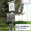
Type of station
Geosphere Austria TAWES-Messstation
these sensors are in use
count
Temperature
1
Air Pressure
1
Precipitation
1
Anemometer
mounting height: 9.84 ft
1
UV
1
Solar radiation
1
Soil temperature
4
Soil moisture
4
Link to station website Langenlois
To map
Compare values with adjacent stations
To instrument page of the station
Sponsoring
MEMBERS
18146 Members at this time
13196 stations online
New stations:
Macisvenda
Vesdun
Pompeiana
Maison
Pinggau
Weather Report
Big Canoe, GA
overcast sky / 66.2°F -
Halesowen
rain / 56.5°F -
Current Warnings
no warnings at the moment
Minimum/ Maximum
Temperature
Gökova
98.1°F -
South Pomfret VT
30.9°F -
Wind Speed
Patscherkofel
44.1 mph - S -
Precipitation
Cedar Rapids, IA
3.3 in -
Visitors today: 6195
currently 68 visitors on AWEKAS
Display Settings
Language
German
English
Dutch
French
Italian
Spanish
Measurement Units
Metric system
American system