Home
Weather Maps
Tables
Forum
Community
Service
Shop
My AWEKAS
AWEKAS Home
AWEKAS Mobile Home
Data protection
Imprint
Weather overview
Temperature
Air Pressure
Wind
Precipitation
Snow
Webcam
Sun
Dew point
Humidity
Current weather data
Current weather situation
Current weather warnings
Forum overview
News
Help and instructions
Wishes and suggestions
Register new
Memberlist
Member Map
Donations to AWEKAS
Banner and logo
Weather widget
AWEKAS shop
My station panel
Instrument designer
Stationsweb
Change user data
Report your weather
Data import/export
AWEKAS Benutzer:
login
Nearest stations
Information for station Dornbirn
Bregenz Nord
Alberschwende
Altenrhein MCH
Bregenz
Bregenz Süd
Buechberg
Dornbirn West
Feldkirch Geosphere
Fraxern
Gemeinde Hörbranz
Götzis Nord
Hohenems
Karren (Bergstation)
Langenegg
Lindau DWD
Lindau Realschule
Lindau, Insel
Lindau-Degelstein
Niederstaufen
Oberriet MCH
Rankweil
Rankweil-Brederis
Riefensberg
Rohrspitz
Sigmarszell DWD
Sulzberg
Widnau (SG)
Station name
Dornbirn
Country
Austria
Height above sea level
407 m
Geographical position
9° 43' 32'' East / 47° 25' 57'' North
Data transfer
manuell
Last updated
11/18/2025 2:30 am
AWEKAS Plus
YES
AWEKAS id
43602
Stations blog
edit
no station blog available
Information for station
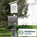
Type of station
Geosphere Austria TAWES-Messstation
these sensors are in use
count
Temperature
1
Air Pressure
1
Precipitation
1
Anemometer
mounting height: 9.84 ft
1
UV
1
Solar radiation
1
Soil temperature
4
Soil moisture
4
Link to station website Dornbirn
To map
Compare values with adjacent stations
To instrument page of the station
Sponsoring
MEMBERS
18373 Members at this time
13103 stations online
New stations:
SIBIU
Burglengenfeld - Am
Orø
Alkoven Puchham
Wolsztyn
Weather Report
Hartberg / Kroisbach
heavy cloud / 41.2°F -
Big Canoe, GA
overcast sky / 55.6°F -
Current Warnings
Heidelberg/Kirchheim
extreme cold <-20°C
Minimum/ Maximum
Temperature
Plum MF
88.3°F -
Brunnenkogel / Oetzt
0.3°F -
Wind Speed
Dosso di Costalta
39.8 mph - NE -
Precipitation
Plumas Lake, CA
1.8 in -
Visitors today: 266
currently 7 visitors on AWEKAS
Display Settings
Language
German
English
Dutch
French
Italian
Spanish
Measurement Units
Metric system
American system