Home
Weather Maps
Tables
Forum
Community
Service
Shop
My AWEKAS
AWEKAS Home
AWEKAS Mobile Home
Data protection
Imprint
Weather overview
Temperature
Air Pressure
Wind
Precipitation
Snow
Webcam
Sun
Dew point
Humidity
Current weather data
Current weather situation
Current weather warnings
Forum overview
News
Help and instructions
Wishes and suggestions
Register new
Memberlist
Member Map
Donations to AWEKAS
Banner and logo
Weather widget
AWEKAS shop
My station panel
Instrument designer
Stationsweb
Change user data
Report your weather
Data import/export
AWEKAS Benutzer:
login
Nearest stations
Information for station St. Pölten
Ambach
Bischofstetten
Böheimkirchen II
Böheimkirchen III
Böheimkirchen-Mitte
Fugging
Gansbach
Harland
Herzogenburg-WW
Kapelln/Perschling
Kasten bei Böheimk.
Lilienfeld
Lilienfeld-Dörfl
Loosdorf (NÖ)
Mauterheim
Ober-Grafendorf-Grub
Oberloitzenberg
Oberndorf i.d. Ebene
Oberwölbling
Perschling
Pielachtalsdlg
Plambach
Prinzersdorf
Rabenstein(Pielach)
Sankt Christophen
Siedlung Reith (WHB)
St. Pölten-Harland
St. Pölten-Viehofen
St.Poelten Landhaus
St.Pölten-Teufelhof
St.Pölten-Viehofen
Stollberg NÖ
Tonach
Traisen
Unterpirat / Brand
Viehofen(St. Pölten)
Weißenkir./Perschlg.
Station name
St. Pölten
Country
Austria
Height above sea level
280 m
Geographical position
15° 37' 26.41'' East / 48° 10' 52.69'' North
Data transfer
Bresser Fastlink
Last updated
9/22/2025 11:40 am
AWEKAS Plus
YES
AWEKAS id
36551
Stations blog
edit
no station blog available
Information for station
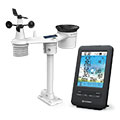
Type of station
BRESSER 4-Tage 4CAST 7003200
these sensors are in use
count
Temperature
1
Air Pressure
1
Precipitation
1
Anemometer
mounting height: 6.56 ft
1
UV
1
Solar radiation
1
To map
Compare values with adjacent stations
To instrument page of the station
Sponsoring
MEMBERS
18151 Members at this time
13227 stations online
New stations:
Villanueva de Mena
Hepstedt
Tüngental 2
Tüngental
Almiros Corfu GR
Weather Report
Löffelsterz
light rain / 48.4°F -
Albertville
heavy cloud / 63.1°F -
Current Warnings
no warnings at the moment
Minimum/ Maximum
Temperature
Kanagala
93°F -
Pic Du Midi - Obs MF
27.1°F -
Wind Speed
Kionia - Tinos
35.3 mph - N -
Precipitation
Cuneo-Falchetto
8.7 in -
Visitors today: 5469
currently 58 visitors on AWEKAS
Display Settings
Language
German
English
Dutch
French
Italian
Spanish
Measurement Units
Metric system
American system