Home
Weather Maps
Tables
Forum
Community
Service
Shop
My AWEKAS
AWEKAS Home
AWEKAS Mobile Home
Data protection
Imprint
Weather overview
Temperature
Air Pressure
Wind
Precipitation
Snow
Webcam
Sun
Dew point
Humidity
Current weather data
Current weather situation
Current weather warnings
Forum overview
News
Help and instructions
Wishes and suggestions
Register new
Memberlist
Member Map
Donations to AWEKAS
Banner and logo
Weather widget
AWEKAS shop
My station panel
Instrument designer
Stationsweb
Change user data
Report your weather
Data import/export
AWEKAS Benutzer:
login
Nearest stations
Information for station Laaber-Waldetzenberg
Burglengenfeld 2
Frauenberg-Pettenhof
Hemau
Hemau-Pellndorf
Kleinetzenberg
Polzhausen
Regensburg
Regensburg DWD
Regensburg-Sallern
Regenstauf
Regenstauf (Süd)
Regenstauf-Diesenb.
Riedenburg
Saxberg
Sinzing-Viehhausen
Wenzenb.-Fussenberg
Station name
Laaber-Waldetzenberg
Country
Germany
Height above sea level
482 m
Geographical position
11° 55' 39.86'' East / 49° 2' 43.69'' North
Data transfer
Froggit Fastlink
Last updated
15.1.2026 00:20
AWEKAS Plus
YES
AWEKAS id
32009
Stations blog
edit
no station blog available
Information for station
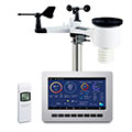
Type of station
Froggit HP1000SE PRO
these sensors are in use
count
Temperature
ventilated radiation shield
1
Air Pressure
1
Precipitation
1
Anemometer
mounting height: 2 m
1
UV
1
Solar radiation
1
Soil temperature
4
Link to station website Laaber-Waldetzenberg
To map
Compare values with adjacent stations
To instrument page of the station
Sponsoring
MEMBERS
19877 Members at this time
13565 stations online
New stations:
Hemer-Brockhausen
Rissing (Cham)
st. Georgen am Walde
South Section
Torrox Faro AE
Weather Report
Big Canoe, GA
overcast sky / 5.9°C -
Blue Ridge, GA
rain / 5.5°C -
Current Warnings
no warnings at the moment
Minimum/ Maximum
Temperature
Port Laguerre MF
34.1°C -
Ilyino
-33.2°C -
Wind Speed
La Dôle MCH
52.9km/h - W -
Precipitation
Bellecombe-jacob MF
271.8 l/m² -
Visitors today: 9296
currently 28 visitors on AWEKAS
Display Settings
Language
German
English
Dutch
French
Italian
Spanish
Measurement Units
Metric system
American system