Home
Weather Maps
Tables
Forum
Community
Service
Shop
My AWEKAS
AWEKAS Home
AWEKAS Mobile Home
Data protection
Imprint
Weather overview
Temperature
Air Pressure
Wind
Precipitation
Snow
Webcam
Sun
Dew point
Humidity
Current weather data
Current weather situation
Current weather warnings
Forum overview
News
Help and instructions
Wishes and suggestions
Register new
Memberlist
Member Map
Donations to AWEKAS
Banner and logo
Weather widget
AWEKAS shop
My station panel
Instrument designer
Stationsweb
Change user data
Report your weather
Data import/export
AWEKAS Benutzer:
login
Nearest stations
Information for station Hinteregg
Birkfeld
Birkfeld Nord
Birkfeld-Hohlenstein
Eichberg
Flattendorf
Gersdorf a.d.F
Gleisdorf Geosphere
Grafendorf b.Hartb.2
Hartberg
Hartberg (Safenau)
Hartberg-Ring
Hartberg-Stadt
Hartensdorf
Kaindorf/H.
Markt Allhau
Masenberg
Niesenpoint
Pischelsdorf (Stmk.)
Pöllau
Pöllau Zeil
Pöllau, Prätis
Reichendorf
Riegersbach (Stmk.)
Rohrbach a.d.Lafnitz
Rohrbach An Der Lafn
Rollsdorf
St.Johan/Herberstein
Staudach-Greinbach
Vorau
Wagenbach/Ebersdorf
Weiz
Woerterberg
Wollsdorf
Zeilerviertel
Station name
Hinteregg
Country
Austria
Height above sea level
515 m
Geographical position
15° 51' 18.11'' East / 47° 14' 43.24'' North
Data transfer
WU Fastlink
Last updated
18.6.2025 01:42
AWEKAS Plus
YES
AWEKAS id
27914
Stations blog
edit
no station blog available
Information for station
Type of station
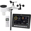
dnt WeatherScreen PRO DNT000008
these sensors are in use
count
Temperature
1
Air Pressure
1
Precipitation
1
Anemometer
mounting height: 1.5 m
1
UV
1
Solar radiation
1
Soil temperature
4
Soil moisture
4
Leaf wetness
2
To map
Compare values with adjacent stations
To instrument page of the station
Sponsoring
MEMBERS
14861 Members at this time
10175 stations online
New stations:
Friedrichsdorf
Langendorf
Krankenhagen
Senftenberg
Hobisstation
Weather Report
Big Canoe, GA
overcast sky / 20.2°C -
Blue Ridge, GA
drizzle / 19.1°C -
Current Warnings
no warnings at the moment
Minimum/ Maximum
Temperature
Phoenix-Foothills,AZ
42.7°C -
Balfour
-0.3°C -
Wind Speed
Hovåshöjd
43.8km/h - W -
Precipitation
Greenwich, NY
77.2 l/m² -
Visitors today: 210
currently 4 visitors on AWEKAS
Display Settings
Language
German
English
Dutch
French
Italian
Spanish
Measurement Units
Metric system
American system