Home
Weather Maps
Tables
Forum
Community
Service
Shop
My AWEKAS
AWEKAS Home
AWEKAS Mobile Home
Data protection
Imprint
Weather overview
Temperature
Air Pressure
Wind
Precipitation
Snow
Webcam
Sun
Dew point
Humidity
Current weather data
Current weather situation
Current weather warnings
Forum overview
News
Help and instructions
Wishes and suggestions
Register new
Memberlist
Member Map
Donations to AWEKAS
Banner and logo
Weather widget
AWEKAS shop
My station panel
Instrument designer
Stationsweb
Change user data
Report your weather
Data import/export
AWEKAS Benutzer:
login
Nearest stations
Information for station Warendorf-Milte
Bad Iburg II
Bad Laer
Bad Rothenfelde
Ennigerl.-Sommersell
Ennigerloh-Ostenfeld
Freckenhorst Nord
Gröblingen
Hilter a.Teutob.Wald
Ladbergen-Moorsiedlg
Lengerich-Hohne
Lienen-Höchste
Lienen-Holperdorp
Münster Wolbeck
Ostbevern
Sassenberg-Ost
Sassenbg.-Gröblingen
Sendenh.-Elmenhorst
Sentrup
Telgte Nord
Telgte Süd
Telgte-Altstadt
Telgte-Vadrup
Versmold-Zentrum
Warendorf (Süd)
Warendorf, Emssee
Station name
Warendorf-Milte
Country
Germany
Height above sea level
42 m
Geographical position
7° 56' 47.44'' East / 52° 0' 8.92'' North
Data transfer
WU Fastlink
Last updated
1/10/2026 1:37 am
AWEKAS Plus
YES
AWEKAS id
27721
Stations blog
edit
no station blog available
Information for station
Type of station
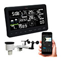
Ventus WiFi-Wetterstation W830
these sensors are in use
count
Temperature
1
Air Pressure
1
Precipitation
1
Anemometer
mounting height: 22.97 ft
1
UV
1
Solar radiation
1
Soil temperature
4
Soil moisture
4
Leaf wetness
2
To map
Compare values with adjacent stations
To instrument page of the station
Sponsoring
MEMBERS
19846 Members at this time
14190 stations online
New stations:
Boskruin
Vedrin
Steinberg
Hörzingerwald
Puchkirchen City
Weather Report
Sibenik-Krvavice
cloudy / 50.5°F -
Cuers
heavy cloud / 44.2°F -
Current Warnings
Hannover-Bemerode
snowdrift
Minimum/ Maximum
Temperature
Menangle
97.9°F -
Kuusamo, Räväntie
-36.9°F -
Wind Speed
Leuchtturm Kiel DWD
50.8 mph - E -
Precipitation
Ellisville, MS
2.9 in -
Visitors today: 228
currently 33 visitors on AWEKAS
Display Settings
Language
German
English
Dutch
French
Italian
Spanish
Measurement Units
Metric system
American system