Home
Weather Maps
Tables
Forum
Community
Service
Shop
My AWEKAS
AWEKAS Home
AWEKAS Mobile Home
Data protection
Imprint
Weather overview
Temperature
Air Pressure
Wind
Precipitation
Snow
Webcam
Sun
Dew point
Humidity
Current weather data
Current weather situation
Current weather warnings
Forum overview
News
Help and instructions
Wishes and suggestions
Register new
Memberlist
Member Map
Donations to AWEKAS
Banner and logo
Weather widget
AWEKAS shop
My station panel
Instrument designer
Stationsweb
Change user data
Report your weather
Data import/export
AWEKAS Benutzer:
login
Nearest stations
Information for station Schellerten-Dingelbe
Ahrbergen
Algermissen DWD
Algermissen West
Berel
Bockenem
Bockenem-Ost
Bodenburg
Diekholzen
Elbe, Klein Elbe
Groß Düngen
Groß Ilde
Groß Lafferde
Harsum
Harsum-Nord
Hildesheim-Itzum
Hohenhameln
Holle NDS
Holle-Grasdorf
Ilsede-Solschen
Lehrte-Hämelerwald
Lengede Broistedt
Lengede Woltwiesche
Lengede-Broistedt
Nettlingen
Nettlingen-Nord
Oberg
Peine Süd
Peine-Rosenthal
Peine-Vöhrum
Salzgitter-Engerode
SalzgitterLebenstedt
Sarstedt
Sarstedt-Hotteln
Sehlde
SZ Gebhardshagen
SZ-Engelnstedt
Vechelde-Liedingen
Station name
Schellerten-Dingelbe
Country
Germany
Height above sea level
89 m
Geographical position
10° 7' 58.1'' East / 52° 10' 20.5'' North
Data transfer
WU Fastlink
Last updated
20.11.2025 08:17
AWEKAS Plus
YES
AWEKAS id
24039
Stations blog
edit
no station blog available
Information for station
Type of station
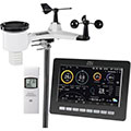
dnt WeatherScreen PRO DNT000008
these sensors are in use
count
Temperature
1
Air Pressure
1
Precipitation
1
Anemometer
mounting height: 1.5 m
1
UV
1
Solar radiation
1
Soil temperature
1
Link to station website Schellerten-Dingelbe
To map
Compare values with adjacent stations
To instrument page of the station
Sponsoring
MEMBERS
18379 Members at this time
13125 stations online
New stations:
Brigada Aérea 2 SMFA
Auerbach Oberpfalz
(A)-Sigless
Mil Palmeras
AB Etten-Leur
Weather Report
Sibenik-Krvavice
clear / 11.8°C -
Hartberg / Kroisbach
heavy cloud / 1.5°C -
Current Warnings
no warnings at the moment
Minimum/ Maximum
Temperature
Monto, QLD
34.7°C -
Slagnäs, Gasa
-24.7°C -
Wind Speed
Villacher Alpe
57.6km/h - SW -
Precipitation
Santa Clarita MC, CA
192.5 l/m² -
Visitors today: 1633
currently 33 visitors on AWEKAS
Display Settings
Language
German
English
Dutch
French
Italian
Spanish
Measurement Units
Metric system
American system