Home
Weather Maps
Tables
Forum
Community
Service
Shop
My AWEKAS
AWEKAS Home
AWEKAS Mobile Home
Data protection
Imprint
Weather overview
Temperature
Air Pressure
Wind
Precipitation
Snow
Webcam
Sun
Dew point
Humidity
Current weather data
Current weather situation
Current weather warnings
Forum overview
News
Help and instructions
Wishes and suggestions
Register new
Memberlist
Member Map
Donations to AWEKAS
Banner and logo
Weather widget
AWEKAS shop
My station panel
Instrument designer
Stationsweb
Change user data
Report your weather
Data import/export
AWEKAS Benutzer:
login
Nearest stations
Information for station Soriano - Pantane
Ronciglione (VT)
Soriano nel Cimino
Viterbo zona Pila
Station name
Soriano - Pantane
Country
Italy
Height above sea level
300 m
Geographical position
12° 15' 55.18'' East / 42° 26' 27.59'' North
Data transfer
Cumulus MX Direct Link
Last updated
10/12/2023 8:45 am
AWEKAS Plus
NO
AWEKAS id
20451
Stations blog
edit
no station blog available
Information for station
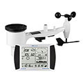
Type of station
PCE-FWS 20N
these sensors are in use
count
Temperature
1
Air Pressure
1
Precipitation
1
Anemometer
mounting height: 32.81 ft
1
Link to station website Soriano - Pantane
To map
Compare values with adjacent stations
To instrument page of the station
Sponsoring
MEMBERS
18305 Members at this time
12710 stations online
New stations:
Sant Cugat
Fuerth
Taura-Köthensdorf 2
Langenwang
Paducah, KY
Weather Report
Lochaber
overcast sky / 48°F -
Köln-Wahn
rain / 51.6°F -
Current Warnings
no warnings at the moment
Minimum/ Maximum
Temperature
Regina MF
92.3°F -
Aiguille Du Midi MF
10.2°F -
Wind Speed
Le Dramont MF
46.3 mph - W -
Precipitation
St-Georges-les-Bains
2.6 in -
Visitors today: 5048
currently 43 visitors on AWEKAS
Display Settings
Language
German
English
Dutch
French
Italian
Spanish
Measurement Units
Metric system
American system