Home
Weather Maps
Tables
Forum
Community
Service
Shop
My AWEKAS
AWEKAS Home
AWEKAS Mobile Home
Data protection
Imprint
Weather overview
Temperature
Air Pressure
Wind
Precipitation
Snow
Webcam
Sun
Dew point
Humidity
Current weather data
Current weather situation
Current weather warnings
Forum overview
News
Help and instructions
Wishes and suggestions
Register new
Memberlist
Member Map
Donations to AWEKAS
Banner and logo
Weather widget
AWEKAS shop
My station panel
Instrument designer
Stationsweb
Change user data
Report your weather
Data import/export
AWEKAS Benutzer:
login
Nearest stations
Information for station Hagen a.T.W.
Bad Iburg II
Bad Rothenfelde
Belm
Belm DWD
Belm-Haltern
Dodesheide
Georgsmarienhütte
Georgsmarienhütte 1
Hagen, Natrup-Hagen
Hilter a.Teutob.Wald
Holzhausen OS
Ibbenbüren-Laggenb.
Ladbergen-Moorsiedlg
Lengerich-Hohne
Lienen-Höchste
Lienen-Holperdorp
Osnabrück-Kalkhügel
Osnabrück-Voxtrup
Osnabrück-Weststadt
Ostbevern
Sentrup
Wallenhorst-Hollage
Station name
Hagen a.T.W.
Country
Germany
Height above sea level
110 m
Geographical position
7° 59' 1.51'' East / 52° 11' 37.25'' North
Data transfer
WU Fastlink
Last updated
8/20/2025 2:30 pm
AWEKAS Plus
NO
AWEKAS id
16756
Stations blog
edit
no station blog available
Information for station
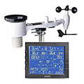
Type of station
Ecowitt WS2320
these sensors are in use
count
Temperature
1
Air Pressure
1
Precipitation
1
Anemometer
mounting height: 8.2 ft
1
UV
1
Solar radiation
1
To map
Compare values with adjacent stations
To instrument page of the station
Sponsoring
MEMBERS
17987 Members at this time
13185 stations online
New stations:
Untertoellern
Clinton Bluff
Strettoia
Lohmen 02
Sorgenlos
Weather Report
Chatel-Guyon
heavy cloud / 68.9°F -
Cuers
heavy cloud / 81°F -
Current Warnings
no warnings at the moment
Minimum/ Maximum
Temperature
Téboursouk
105.4°F -
Jungfraujoch MCH
33.1°F -
Wind Speed
Geitanger, Øygarden
33 mph - NW -
Precipitation
Hauts De Sainte-r MF
5.8 in -
Visitors today: 4904
currently 55 visitors on AWEKAS
Display Settings
Language
German
English
Dutch
French
Italian
Spanish
Measurement Units
Metric system
American system