Facebook
 
 AWEKAS Benutzer: login  
Nearest stations  
Information for station Kahla (Thür)
Bodelwitz
Jena (Sternwarte) DW
Jena-Cospeda
Jena-Kernberge
Jena-Nord
Jena-ZiegenhainerTal
Jena-Zwätzen
Krölpa-Rockend. DWD
Meusebach
Mörsdorf West
Pößneck
Schmieritz-Weltwitz
Wernburg
 
  Station name Kahla (Thür)  
Country Germany   
Height above sea level 176 m
Geographical position     11° 35' 23'' East / 50° 48' 19'' North
Data transfer WSWIN Direct Link
Last updated 5.10.2025 22:00
AWEKAS Plus YES  
AWEKAS id 6145
 
  Stations blog edit  
 
no station blog available
 
 
Information for station
station Type of station  Cresta WXR815
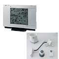
these sensors are in use count
Temperature 1
Air Pressure 1
Precipitation heated1
Anemometer mounting height: 13 m1
 
Link to station website Kahla (Thür)
To map
Compare values with adjacent stations
To instrument page of the station
 
 
info
 
Sponsoring
MEMBERS
18202 Members at this time
13045 stations online
New stations:
Plum MF
Brawinkl 16
Groenedijk
Elice PE
Wolfratshausen 2
 
 
Weather Report
Hartberg / Kroisbach
 cloudy / 7.4°C -
Big Canoe, GA
 rain / 17.4°C -
no warnings at the moment
Minimum/ Maximum
Temperature

Anping Tainan City
35°C -
Aiguille Du Midi MF
-13.9°C -
Wind Speed
Fehmarn DWD
67km/h - W -
Precipitation
Riverton, WY
113.8 l/m² -
 
Visitors today: 2385
currently 53 visitors on AWEKAS
Display Settings
Language
German English
Dutch French
Italian Spanish
Measurement Units
Metric system
American system