Facebook
 
 AWEKAS Benutzer: login  
Nearest stations  
Information for station Fürstenzell DWD
Aicha vorm Wald
Aldersbach-Vogler
Brunnenthal-Kreuzb.
Bubing
Büchlberg
Dorfbach Ortenburg
Edt
Fürstenz.-Engertsham
Gögging
Haarbach-Anderlwies
Hausmanning
Heinriching
Krennbauer Grub
Neukirchen am Inn
Obernzell-Haar
Ortenburg
Passau-Hacklberg
Passau-Rittsteig
Pocking
Ringlholz
Ruderting
Ruhstorf a.d. Rott
Schaerding
Schärding
Schärding I
Tettenham
Tettenweis
Tettenweis Nord
Tettenweis-Droinend
Thyrnau-Kellberg
Tittling
Vilshofen-Aunkirchen
Wernstein am Inn
Wernstein--Öhret
Wernstein/Stöbichen
 
  Station name Fürstenzell DWD  
Country Germany   
Height above sea level 476 m
Geographical position     13° 21' 11.52'' East / 48° 32' 42.36'' North
Data transfer manuell
Last updated 27.12.2025 12:20
AWEKAS Plus YES  
AWEKAS id 44370
 
  Stations blog edit  
 
no station blog available
 
 
Information for station
station Type of station  DWD-Wetterstation
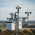
these sensors are in use count
Temperature 1
Air Pressure 1
Precipitation 1
Anemometer mounting height: 3 m1
UV 1
Solar radiation 1
Soil temperature 4
 
Link to station website Fürstenzell DWD
 
To map
Compare values with adjacent stations
To instrument page of the station
 
 
info
 
Sponsoring
MEMBERS
19402 Members at this time
13405 stations online
New stations:
Villardeciervos AE
Carboneras - Faro AE
Pradollano Parqu AE
Sabinosa-Balneari AE
El Hierro/Aeropue AE
 
 
Weather Report
Viviers
 sunny sky / 3.1°C -
Studen BE
 cloudy -
no warnings at the moment
Minimum/ Maximum
Temperature

Skemerhoek (Akanous)
34.7°C -
Royal Oak(Calgary)
-21°C -
Wind Speed
Mälgviken Bräcke
74.5km/h - NW -
Precipitation
Pirae 1 MF
73.7 l/m² -
 
Visitors today: 4070
currently 67 visitors on AWEKAS
Display Settings
Language
German English
Dutch French
Italian Spanish
Measurement Units
Metric system
American system