
|
Country
Austria
 Height above sea level
421 m
15° 18' 54'' East / 47° 15' 20'' North
Data transfer
manuell
Last updated
5.5.2026 02:30
AWEKAS Plus
YES
AWEKAS id
43617
|
|---|

|
||||
|---|---|---|---|---|
|
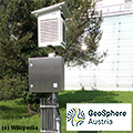
Information for station
Type of station
Geosphere Austria TAWES-Messstation
 these sensors are in use count
Temperature 1 Air Pressure 1 Precipitation 1 Anemometer mounting height: 3 m 1 UV 1 Solar radiation 1 Soil temperature 4 Soil moisture 4 Leaf wetness 2 Extra humidity sensor 4 Air quality sensor 1
|
|---|