
|
Country
Germany
 Height above sea level
42 m
13° 37' 44.43'' East / 52° 29' 13.41'' North
Data transfer
Bresser Fastlink
Last updated
29.5.2026 19:01
AWEKAS Plus
YES
AWEKAS id
42699
|
|---|

|
||||
|---|---|---|---|---|
|
Information for station
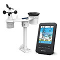
Type of station
BRESSER 4-Tage 4CAST 7003200
 these sensors are in use count
Temperature 1 Air Pressure 1 Precipitation 1 Anemometer mounting height: 9 m 1 UV 1 Solar radiation 1 Soil temperature 4 Soil moisture 4 Leaf wetness 2 Extra humidity sensor 4 Air quality sensor 1
|
|---|