
|
Country
Austria
 Height above sea level
369 m
13° 26' 56.97'' East / 48° 28' 16.8'' North
Data transfer
Bresser Fastlink
Last updated
4.5.2026 18:11
AWEKAS Plus
YES
AWEKAS id
37176
|
|---|

|
||||
|---|---|---|---|---|
|
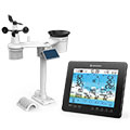
Information for station
Type of station
BRESSER 6-Tage 4CAST PRO 7003210
 these sensors are in use count
Temperature 1 Air Pressure 1 Precipitation 1 Anemometer mounting height: 3 m 1 UV 1 Solar radiation 1 Air quality sensor 1
|
|---|