
|
Country
Germany
 Height above sea level
335 m
13° 17' 2.69'' East / 48° 25' 14.75'' North
Data transfer
Bresser Fastlink
Last updated
19.3.2026 20:12
AWEKAS Plus
YES
AWEKAS id
35230
|
|---|

|
||||
|---|---|---|---|---|
|
Information for station
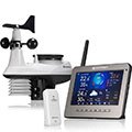
Type of station
BRESSER WLAN HD TFT 7003500
 these sensors are in use count
Temperature 1 Air Pressure 1 Precipitation 1 Anemometer mounting height: 10 m 1 UV 1 Solar radiation 1 Soil temperature 4 Soil moisture 4 Leaf wetness 2 Extra humidity sensor 4 Air quality sensor 1
|
|---|