
|
Country
Austria
 Height above sea level
446 m
14° 16' 15.73'' East / 46° 36' 46.21'' North
Data transfer
Bresser Fastlink
Last updated
25.7.2026 07:15
AWEKAS Plus
YES
AWEKAS id
35197
|
|---|

|
||||
|---|---|---|---|---|
|
Information for station
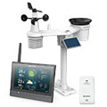
Type of station
BRESSER MeteoChamp HD 7003510
 these sensors are in use count
Temperature 1 Air Pressure 1 Precipitation 1 Anemometer mounting height: 2 m 1 UV 1 Solar radiation 1
|
|---|