
|
Country
Germany
 Height above sea level
487 m
12° 8' 10.06'' East / 48° 23' 42.46'' North
Data transfer
Bresser Fastlink
Last updated
15.12.2025 14:47
AWEKAS Plus
YES
AWEKAS id
35091
|
|---|

|
||||
|---|---|---|---|---|
|
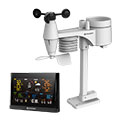
Information for station
Type of station
BRESSER WLAN Comfort 7003300
 these sensors are in use count
Temperature 1 Air Pressure 1 Precipitation 1 Anemometer mounting height: 2 m 1 UV 1 Solar radiation 1
|
|---|