
|
Country
Germany
 Height above sea level
140 m
6° 30' 2.44'' East / 49° 43' 13.85'' North
Data transfer
Bresser Fastlink
Last updated
12.7.2026 10:48
AWEKAS Plus
NO
AWEKAS id
34397
|
|---|

|
||||
|---|---|---|---|---|
|
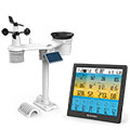
Information for station
Type of station
BRESSER 6-Tage 4CAST PRO SF 7003220
 these sensors are in use count
Temperature 1 Air Pressure 1 Precipitation 1 Anemometer : 1 UV 1 Solar radiation 1 Air quality sensor 1
|
|---|