Facebook
 
 AWEKAS Benutzer: login  
Nearest stations  
Information for station Torhout-West
Ardooie
Eernegem
Leestje (Wingene)
Lichtervelde
Loppem (Zedelgem)
Passendale
Tielt
Zedelgem
 
  Station name Torhout-West  
Country Belgium   
Height above sea level 22 m
Geographical position     3° 5' 20.5'' East / 51° 3' 49.72'' North
Data transfer Bresser Fastlink
Last updated 11/4/2025 6:55 am
AWEKAS Plus YES  
AWEKAS id 31738
 
  Stations blog edit  
 
no station blog available
 
 
Information for station
station Type of station  BRESSER WLAN Comfort 7003300
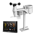
these sensors are in use count
Temperature ventilated radiation shield 1
Air Pressure 1
Precipitation 1
Anemometer mounting height: 7.22 ft1
UV 1
Solar radiation 1
 
 
To map
Compare values with adjacent stations
To instrument page of the station
 
 
info
 
Sponsoring
MEMBERS
18308 Members at this time
13111 stations online
New stations:
Schwabach Süd
Sant Cugat
Fuerth
Moosburg an der Isar
Menslage
 
 
Weather Report
Goshawk
 heavy cloud -
Big Canoe, GA
 overcast sky / 48.4°F -
no warnings at the moment
Minimum/ Maximum
Temperature

Mooroobool (Cairns)
88.9°F -
Ilyino
14.5°F -
Wind Speed
Iraty Orgambide MF
50.8 mph - S -
Precipitation
Breda Haagse Beemden
2.4 in -
 
Visitors today: 710
currently 24 visitors on AWEKAS
Display Settings
Language
German English
Dutch French
Italian Spanish
Measurement Units
Metric system
American system