
|
Country
Germany
 Height above sea level
554 m
9° 45' 42.02'' East / 48° 3' 58.68'' North
Data transfer
Froggit Fastlink
Last updated
5.4.2026 00:53
AWEKAS Plus
YES
AWEKAS id
28831
|
|---|

|
||||
|---|---|---|---|---|
|
Information for station
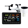
Type of station
Froggit WH3000
 these sensors are in use count
Temperature 1 Air Pressure 1 Precipitation 1 Anemometer mounting height: 2 m 1 UV 1 Solar radiation 1
|
|---|