
|
Country
Austria
 Height above sea level
515 m
15° 51' 18.11'' East / 47° 14' 43.24'' North
Data transfer
WU Fastlink
Last updated
17.9.2025 18:59
AWEKAS Plus
YES
AWEKAS id
27914
|
|---|

|
||||
|---|---|---|---|---|
|
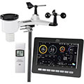
Information for station
Type of station
dnt WeatherScreen PRO DNT000008
 these sensors are in use count
Temperature 1 Air Pressure 1 Precipitation 1 Anemometer mounting height: 1.5 m 1 UV 1 Solar radiation 1 Soil temperature 4 Soil moisture 4 Leaf wetness 2 Extra humidity sensor 4 Air quality sensor 1
|
|---|