
|
Country
 Height above sea level
m
° ' '' East / ° ' '' North
Data transfer
Last updated
26.5.2026 09:40
AWEKAS Plus
NO
AWEKAS id
21114
|
|---|

|
||||
|---|---|---|---|---|
|
Information for station
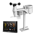
Type of station
BRESSER WLAN Comfort 7003300
 these sensors are in use count
Temperature 1 Precipitation 1 Anemometer mounting height: 9 m 1 UV 1 Solar radiation 1 Soil temperature 4 Soil moisture 1 Extra humidity sensor 4
|
|---|