Facebook
 
 AWEKAS Benutzer: login  
Nearest stations  
Information for station Enschede-Stadsveld
Ahaus Mitte-Nord
Ahaus Nord
Ahaus-Ottenstein
B.Bentheim-Gildehaus
De Lutte
Enschede-Hogeland
Enschede-Laares
Enschede-Rigtersblek
Enschede-Roombeek
Glanerbrug Oost
Gronau-West
Gronau/W. (Nord)
Haaksbergen-Veldmaat
Haaksbergen-Zuid
Hengelo - Hasselo
Hengelo Centrum
Overdinkel
Vreden-Doemern
Vreden-Lünten
 
  Station name Enschede-Stadsveld  
Country Netherlands   
Height above sea level 35 m
Geographical position     6° 51' 33.47'' East / 52° 12' 43.9'' North
Data transfer Davis Weatherlink (HTX Template)
Last updated 25.4.2024 12:02
AWEKAS Plus YES  
AWEKAS id 20704
 
  Stations blog edit  
 
no station blog available
 
 
Information for station
station Type of station  Davis Weather MonitorII
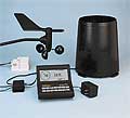
these sensors are in use count
Temperature 1
Air Pressure 1
Precipitation heated1
Anemometer mounting height: 10 m1
 
Link to station website Enschede-Stadsveld
To map
Compare values with adjacent stations
To instrument page of the station
 
 
info
 
Sponsoring
MEMBERS
11684 Members at this time
8673 stations online
New stations:
Simmering
Charleville MEZIERES
Oberhausen
Gamperstraße 17
Greyton
 
 
Weather Report
Bourg-Saint-Bernard
 heavy cloud / 16.1°C -
Tourrette-Levens
 sunny sky / 11.7°C -
no warnings at the moment
Minimum/ Maximum
Temperature

Paramaribo I
34.9°C -
Stüdlhütte
-8.9°C -
Wind Speed
Hantumeruitburen
60.8km/h - SW -
Precipitation
Kottmar-Süd Walddorf
31.8 l/m² -
 
Visitors today: 5142
currently 29 visitors on AWEKAS
Display Settings
Language
German English
Dutch French
Italian Spanish
Measurement Units
Metric system
American system