
|
Country
Germany
 Height above sea level
38 m
8° 35' 1.45'' East / 52° 54' 24.87'' North
Data transfer
Bresser Fastlink
Last updated
5.4.2026 01:43
AWEKAS Plus
YES
AWEKAS id
18584
|
|---|

|
||||
|---|---|---|---|---|
|
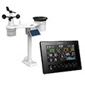
Information for station
Type of station
BRESSER 11-Tage 4CAST (7003240)
 these sensors are in use count
Temperature ventilated radiation shield 1 Air Pressure 1 Precipitation 1 Anemometer mounting height: 3 m 1 UV 1 Solar radiation 1 Soil temperature 1 Soil moisture 1
|
|---|