
|
Country
Germany
 Height above sea level
167 m
7° 22' 40.91'' East / 50° 20' 50.72'' North
Data transfer
Weewx Direct Link
Last updated
2.8.2026 21:26
AWEKAS Plus
NO
AWEKAS id
16878
|
|---|

|
||||
|---|---|---|---|---|
|
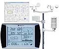
Information for station
Type of station
WS 1080
 these sensors are in use count
Temperature 1 Air Pressure 1 Precipitation 1 Anemometer mounting height: 3 m 1
|
|---|