
|
Country
France
 Height above sea level
63 m
2° 18' 7.31'' West / 48° 39' 48.3'' North
Data transfer
WU Fastlink
Last updated
25.7.2026 20:05
AWEKAS Plus
YES
AWEKAS id
16284
|
|---|

|
||||
|---|---|---|---|---|
|
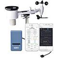
Information for station
Type of station
Ecowitt GW1x00
 these sensors are in use count
Temperature 1 Air Pressure 1 Precipitation 1 Anemometer mounting height: 8 m 1 UV 1 Solar radiation 1 Soil temperature 4 Soil moisture 4 Leaf wetness 2 Extra humidity sensor 4 Air quality sensor 1
|
|---|

Picture from : 8.4.2024 - 01:37
|
|---|