Facebook
 
 AWEKAS gebruiker: login  
nabije stations  
Informatie over het station Wheaton, IL
Batavia, IL
Naperville, IL
Roselle IL
Westmont, IL
 
  Stationsnaam Wheaton, IL  
Land USA   
Zeehoogte 229 m
Geografische Positie    88° 7' 29.78'' West / 41° 51' 41.78'' Noord
Data overdracht Weewx Direct Link
laatst geactualiseerd 10/23/2025 7:55 am
AWEKAS Plus JA  
AWEKAS id 15436
 
  Stations Blog bewerken  
 

Up and running! Decided to beathe some new life into some old equipmnet, as a technology project. The Davis Weather Monitor II was mounted, January 1, 2000 (the turn of the century so to speak). The interface is Weewx, running on an original Raspberry Pi IB+. Serial connectivity, at 1200 baud. Homestation page is AWS S3, and updated on the half-hour.


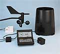
Informatie over Station
station Stationstype  Davis Weather MonitorII
volgende Sensoren zijn aanwezig Aantal
Temperatuur 1
Neerslag 1
Windmeter Montagehoogte: 22.97 ft1
UV 1
Solarstraling 1
Bodemtemperatuur 4
Bodemvocht 4
Bladvocht 2
 
Link naar Stationshomepage Wheaton, IL
 
naar kaart
in vergelijk met buurtstations
naar Instrumentenpagina van het station
 
 
info
 
Sponsoring
Deelnemer
18288 geregistreerde stations
13106 Stations online
De nieuwste Stations:
München
Waldbach Rablkreuz
Rettenegg Wechsel
Las Rozas de Madrid
Neve Ilan
 
 
Weermeldingen
Ceriale (SV)
 mist / 112.3°F -
Blue Ridge, GA
 betrokken / 50.9°F -
momenteel geen waarschuwing aktief
Minimum/ Maximum
Temperatuur

Ceriale (SV)
112.3°F -
Aiguille Du Midi MF
8.1°F -
Windsnelheid
Cagnano MF
45.9 mph - ZW -
Neerslag
Destin, Fl
3 in -
 
Bezoekers vandaag: 177
op dit moment 11 Bezoekers op AWEKAS
Kaartinstelling
Spraak
Duits Engels
Nederlands Frans
Italiaans Spaans
Meetwaarden
Metrische Systeem
Amerikaanse Systeem