
|
Pays
Autriche
 Altitude
440 m
14° 27' 6.61'' Est / 46° 38' 47.41'' Nord
Transmission des données
Bresser Fastlink
dernière mise à jour
14.12.2025 13:19
AWEKAS Plus
NON
AWEKAS id
38794
|
|---|

|
||||
|---|---|---|---|---|
|
Informations sur la station
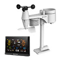
Type de station
BRESSER WLAN Comfort 7003300
 les capteurs suivants sont présents Nombre
Température 1 Pression atmosphérique 1 Précipitations 1 Anémomètre Hauteur de montage: 3 m 1 UV 1 Rayonnement solaire 1 Température du sol 1
|
|---|